Here's a brief description of how it's made: Each grid cell in RTOFS is used to construct a sound speed profile, this is then compared to its eight immediate neighbours in the grid. The comparison is done on ray traced pathways derived from the nine sound speed profiles using a common launch angle (in this case, 30 degrees down from the horizontal). The dispersion of the ray path solutions at their terminal locations is used to quantify the impact of the spatial variability in water mass properties. Ray paths are resampled to a common time increment and the largest travel-time for which there are nine solutions provides us with a point cloud in the two-dimensional depth/distance ray tracing plane. The standard deviation in the vertical dimension is computed for the point cloud and reported along with the geographic position of the grid node. Rinse and repeat for all grid nodes and then make a map. Here's a global map based on the RTOFS grid for Feb. 13, 2012.

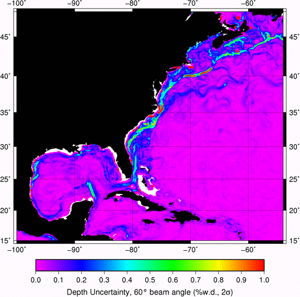
We can zoom in to the Gulf Stream region and have a closer look.

Since the RTOFS grids include a 6 day forecast, we can make an animation of the Gulf Stream area (each frame is 1 day).
We can zoom in even further and see what the NOAA Ship Okeanos Explorer is going to be dealing with on their shake down cruise over the next two weeks (ship track is dashed black line).


No comments:
Post a Comment